

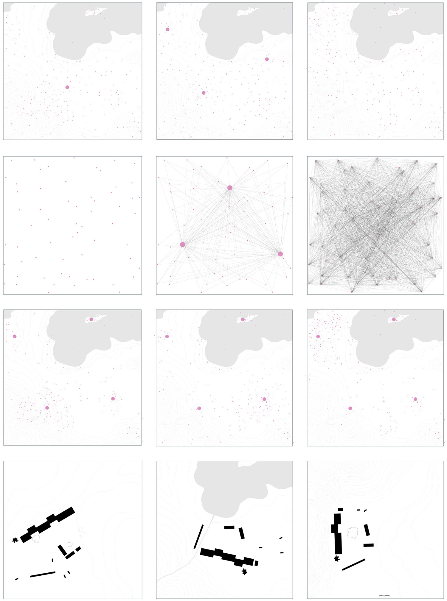
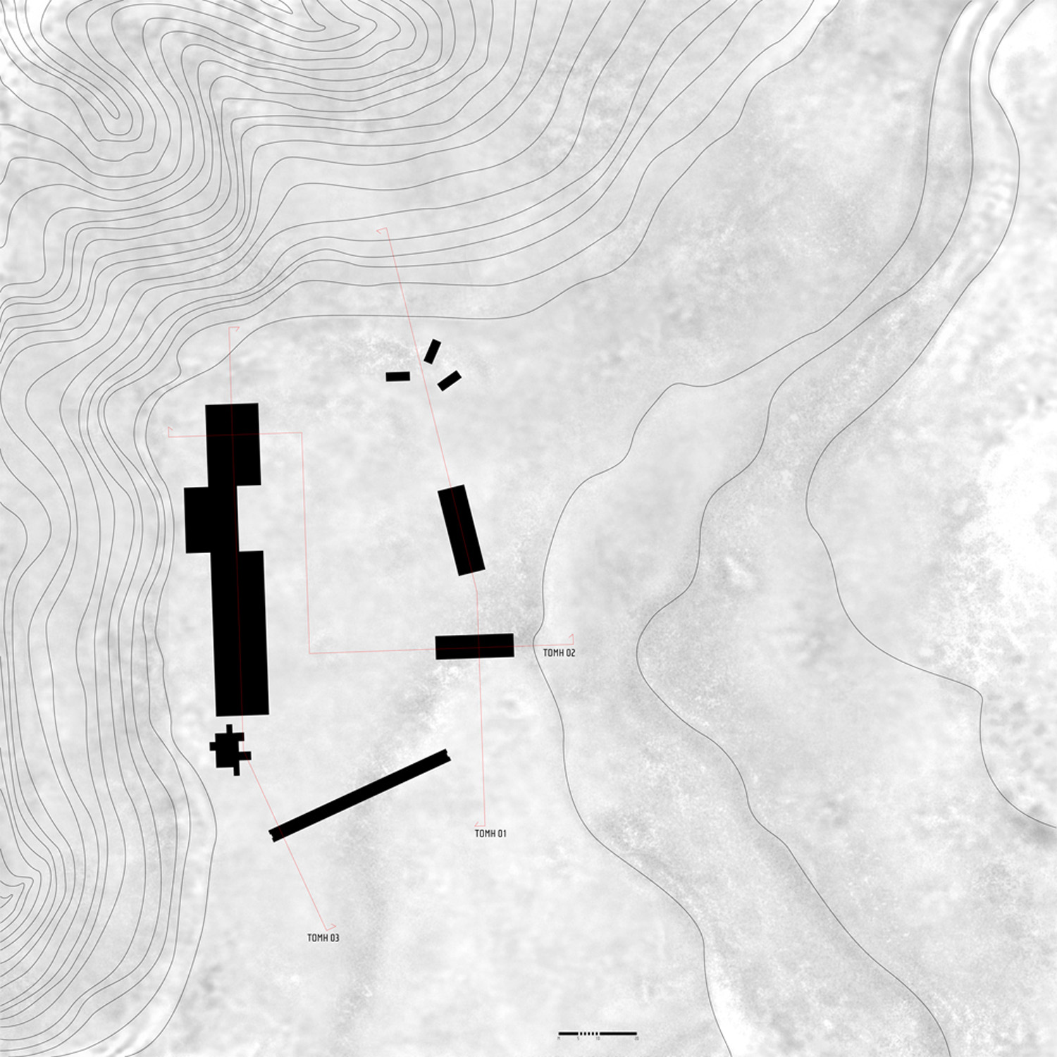
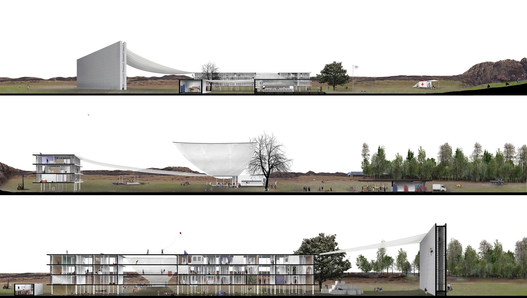
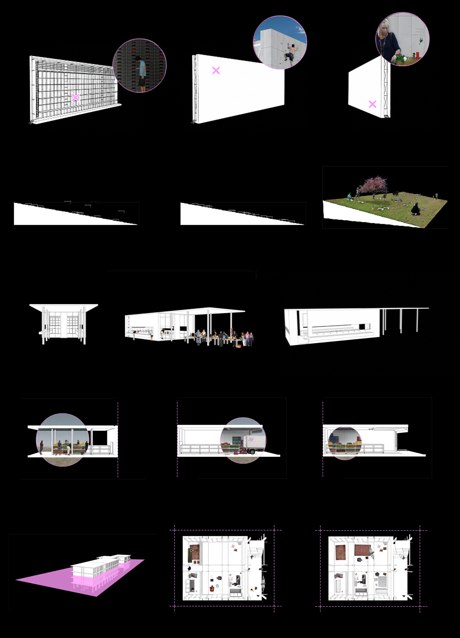

People that chose to leave the regularity of the city, are now organized in an alternative model of countryside reinhabitation.
The combination of a spatial and a digital network is the way for the participants connection and it also includes all the rules that are needed for the functional operation of this “model”. The combination of these networks constitutes a game that is analyzed in frequently movable participants-players, in volatile areas-capacitors and in a network of real cultivable land.
The work creates a fiction view of reality and then presents a kind of a realization of this novel.
Supervisors: Tzirtzilakis Yorgos, Kotionis Zissis
Reference Number: 350

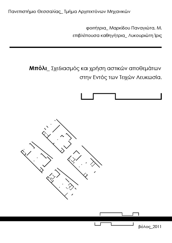
The last 37 years, Cyprus is divided in two, and nowhere is more evident than in the capital city, Nicosia.
Today, the essence of the old districts of Nicosia, is the devalorisation of quality of life and of the urban environment and the economic stagnation as well. Abandoned infrastructures and essential lacks, threaten the possibility of functional survival of wider urban totals, but also the maintenance of valuable samples of architectural and cultural heritage.
The intervention to the city of Nicosia Within the Walls, aims to strengthen and enhance the historical center. The data are treated with extreme caution, with a view to ensure conditions that will contribute to substantially upgrade the quality of residents life and also the region generally. The residential areas are not treated uniquely. However, seeks a mix of compatible uses necessary to ensure a desirable urban environment. Simultaneously, the privacy in the strict sense is reversed, paying particular attention to the socialization of the neighborhood, making social contact as a powerful weapon to remove the fear of the borders. The accommodation of permanent population in traditional built-up cores is encouraged, in order to advantageously be reused the existing reserve of residences and preserve the historical and cultural continuity. Is attempted to spread life in urban level to influence different "layers" to inhabit the area.
Particularly important element is the character of the historic city center and must be treated with the proportional importance. Traditional architecture of Cyprus, is combined with the "modern architecture" without the one negates and reverses the other.
The present thesis aims the rearrangement and planning of urban development. Aims the "grafting", in order to achieve Nicosia ‘s revitalization and invigoration.
Supervisor: Lykourioti Iris
Reference Number: 334

This is an active intervention at the southwest part of Trikala city, by side of Agiamoniotis river.
It includes educational and recreational actions so as to create a social core in the city herself, with which interact and exchanged information. This is about a living organism, a landmark model for the region, a new center which abstains the normal ones and creates dialog with citizens through open actions for all.
Simultaneously with the contribution to the association of non-cases, until today, region with the rest of the city, is been also characterized as a limit border with the industrial side. Principal axis for the evolution of morphology of the project is the coastline of the river and the around road network. Through design, are created flows and pathways interaction shaping the external and internal space of intervention activating a particular diversity, where will be enclosed public action, internalized and channeled in separate independent actions within the building program.
In addition, is developed a new cultivated area usable by all the residents as return to rural society.
Supervisor: Kotionis Zissis
Reference Number: 352
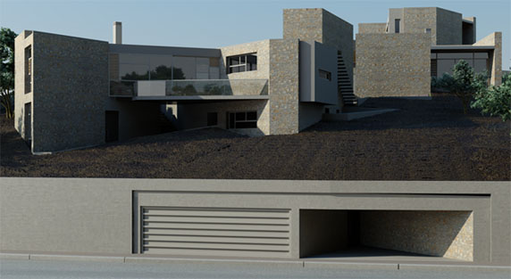
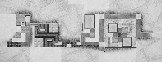
Home ... Really, what does home represents? Gaston Bachelard says that “home is our corner in the world (...), the shelter of our fantasy, the frame in the picture of our memories." In other words, the very personal space for everyone!
Taking this into account, the ambition of the topic is to express the home according to my imagination, my ideal personal space, and my memories of my childhood during summer... The approach was accomplished based on my personal needs, but also without following the already shaped directions and considerations that referring to a home.
A piece of land hidden in an olive grove enhanced with magnificent sea view. Therefore, the olive is the main element of the concept. A series of sequential rules gave the main lines, the grid of lines, which guided the final geometry of the composition. Irregular shapes make the room to lose its absoluteness of the right angle, without acquiring the flexibility of an organic shape.
Supervisor: Manolidis Kostas
Reference Number: 339
Eretria, is a small, seaside town of about 3.156 residents (according to the 2011 population census), which is situated in a distance of 21 Km southeast of Chalkis, in central Euboea. Despite the fact that during ancient times, Eretria was one of the most important political and commercial city-centres of Greece, her recent history begins in 1824, soon after the Greek Revolution of 1821, when refugees from the island of Psara, which has been destroyed earlier by the Ottomans, settled in the area. The modern town was built on top of the remains of the ancient city and was titled as “Nea Psara” until 1960.
Although the city has rapidly developed, particularlyin the field of tourism, during the 20th century and its population has increased since the late ‘90s, there hasn’t been any solution on the issue of the several non-realized urban plans and the trespassing of the archaeological sites continues. The intense construction activity that takes place throughout the municipality of Eretria and its borders, as well as the lack of a design project, that could suggest a unification or a well studied projection of the most important archaeological discoveries, cause an enormous difficulty to the archaeological research and its progress.
The subject of this thesis is an imaginary design project that gives the potential to think and organize a network of movement flows and public spaces along the vertical axis of the existing city plan, in order to unify the archaeological sites, situated on both sides of the axis. The design also creates a link, between the two natural boundaries of Eretria, the north end of the town, where the ancient Acropolis is placed, the mount Olympus and the south end, where the modern port is formed. This particular area is a design subject and an object of interest since 1834, when Cleanthes and Schaubertpresented their neoclassical urban plan, whose guiding lines are still visible nowadays. More recently, within the pages of a study published by the archaeologist Clemens Krause in 1977, the area is characterized as a clearly defined archaeological strictly protected zone, where any construction activity is prohibited.
The design process utilizes several ancient Greek patterns, which can be seen in ancient Greek art and architecture. The usage of these forms as fundamental components of the design, aims to criticize the modern architecture of the area that simply reproduces and uses them so it can be able to bring to the surface the cultural heritage that lies in its fountains. This design approach brings her purpose to a failure, downgrading, among other things, the city’s neoclassical background.
The structures and guiding lines resulting from the patterns are scattered as re-discovered fragments throughout the vertical axis, surrounding from north to south important archeological sites, such as the House of the Mosaics,the Sanctuary of Apollo Daphnephoros, the Tholos in the Agora, the Baths and re-forming the central seaside square of Eretria.
Supervisor: Manolidis Kostas
Reference Number: 359
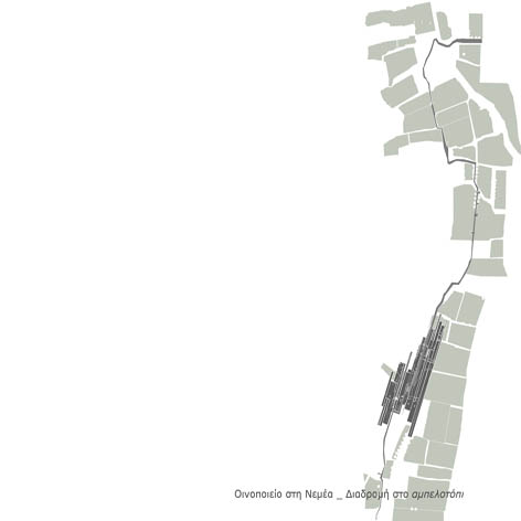
This thesis deals with the design of a winery and a path leading to it. The winery production area and the senses are both offered to implement the above investigation. The proposed route of the landscape contributes to the awaking of the senses too.
The site is on a low hill to the south of the valley of Nemea (Fliountos Hill), close to the sources of Asopos river and has been chosen after field observation combined with the use of aerial photographs.
The aim is to design a modern winery that could be visited and can produce good quality wine at the same time. First of all, it’s an industrial building with a defined production line and secondly, a system of movements and spaces referred to the visitors as well as the route of the landscape.
The building is mostly caved. It consists of a number of terraces- courtyards that are used as nodes to provide further movements into the building. The slope helps the sinking of the building. Only one part is revealed and lets the natural light enter.
All these factors provide the proper conditions for the process of winemaking and at the same time some of the original design goals -related to tactile sense and body movement- are achieved.
Supervisors: Kotionis Zissis, Fyga Dimitra
Reference Number: 329
This thesis focuses on the spatial representation of the subjective time at the urban environment, which is based on the novels “Alice in Wonderland” and “Inside the mirror”. The transliteration of Lewis Carroll’s keywords, such as dream, memory, time, transition, scale, and trace, leads to the creation of an underground sculpture; a path and/or a transition space driving us from the uniformity of the urban network, to a parallel reality. This path is formed as an “urban conduit” growing along the metro tunnel, and is deprived from any notion characterizing the conventional time and space. This new reality is perceived to be spatialized in the in between space of familiar and uncanny, of the existent and imaginative; and describes a new spatial convention which is able to accommodate the city’s dreams.
Elements such as the secret threshold, the accession and the descent to and from the underground network, the light in relation to the movement of the bodies and the cross-section interchange of this underground sculpture, the “framed views” that are created from the holes toward the urban landscape, the scale alterations, the sound of the train’s machine, the accidental “visual meeting” between the walker and the passenger, and the traces that preserve this “communication” with the city, compose a choreography coming up as an alternative, spatial interpretation of Alice’s escape trip to the “Underland”.
Supervisors: Daskalakis Konstantios, Papadopoulos Lois
Reference Number: 338

The study is focused on the majesty and peculiarity of the landscape and how to strengthen them. A mandatory route is created on the cape of Tripiti, the southernmost point of Gavdos, leading to a "window" to the South and the
Libyan Sea.
The main axis of the construction coincides with the north-south axis and creates a bright tear in the rock that offers the possibility of viewing to both of the two points of the horizon, and the descent to the sea in one of the
three Kamareles of the cape.
The biggest section of the construction is subterranean, both to avoid altering the contours and character of the site, partly to oblige the visitor in a particularly dark path which hides the total perception, but surprises by
revealing various interesting elements.
Along the way there is a presentation of various information about the island of Gavdos, and the rest extreme points of Europe, and other continents too.
The building at the end of the route is positioned at this point, not only because it follows the north-south axis, but also because there is an interactive relation and a conscious contrast with the huge existing wooden chair, which turns its back on the south and looks towards the beach of Tripiti and the mountain volumes of Gavdos.
Supervisor: Manolidis Kostas
Reference Number: 343