
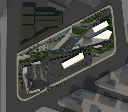
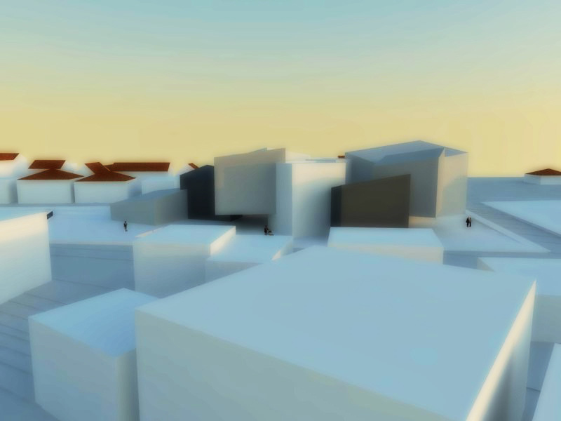
The subject of this project is the formation of a square, in the urban centre of the city of Nicosia.
To create the square is propose to reuse a formal athletic stadium, the so called “old GSP”. The land study preferred, is between the “inside the walls town” and the Pedieos riverbed, while tangential to the main road linking the two areas, and is adjacent to the new theatre of Cyprus Theatre Organisation, which is under construction, and is finishing soon. The area of the site design now used as temporary parking of vehicles.
Settling for the Siting of patterned square was highly significant for the functionality of the central idea, a movement within the space from multiple points and develop a set of walking movements and cycling in the form of trails, with variations in textures of paths obtained by the use of different covering materials as well as shifts in planting of greenery. These trails start from different points in the square and going to particular areas of buildings and focal points, connections to the surrounding area and combined with expanded staging areas. Thus, the initial experience of space is a set of individual passages recruitment landscape.
Two building sections, covering infrastructure facilities referred mainly to social activities. The slabs of the buildings in their effort to follow the action of visitor traffic, give an impression of instantaneous displacement of a point located as to oppose gravity.
An important element of organization of the site study and the region is the parking spaces in underground spaces of the square.
Supervisor: Antonas Aristide
Reference Number: 347

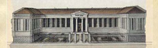
The 18th century appeared large benefactors, one of them, the Zosimas family who founded, among others, the “Zosimaia school”, situated at a bustling crossroad of the old city of Gianena, surrounded by old buildings and abandoned places that stranglehold strangle it, and don’t contribute at all to its highlighting.
After studying closely the surrounding area, the map is being restated and the necessary conditions are being created so that the quality of life of the citizens and the reconstruction and upgrading of the area can be ensured.
Supervisor: Triantafillidis Giorgos
Reference Number: 355
The following thesis project is about the reformation of “Elea” area in Veria, along with the design of building infrastructures.
The reason for the choice of this particular area was the fact that it has been cut off from the rest urban fabric. This design proposal attempts to bring into action the most important key area of the town, a boundary of the city center hat remains unexploited due to its geographical bas-relief.
It is based on the development of an important but at the same time downgraded natural area by incorporating applications that would attract every visitor’s interest. The aim of this proposal is the accession of the parking area, through an undercut construction, to the natural landscape without the loss of its “green” features. In this way a solution to a major problem of the city is recommended while the planted terrace would also be used as a recreation area. With additional inserted usages such as stores, convention centers, internet cafés, bar-restaurants and art galleries, the area would be able to keep the visitors’ interest and avoid ending up being a downgraded and dangerous park once more. The imaginary lines that are created not only by the urban fabric but also by the shape of the particular area, has constituted the basic tracings of the intervention. The shape that arises creates a folded surface which acts as an landscape infrastructure. The design is based on two main strategies: Firstly, on a maximalist style of intervention which is more aggressive, as far as urban planning is concerned, and would result in providing a boost to the area aiming to the landscape embellishment. Secondly, on a strategy of public communication nodes. The presentation consists of designs and area analysis photographs, linear designs, ground plans, elevations and sides of the reformation project, along with the supporting buildings and three-dimensional representations of the proposal. Additionally, it is accompanied by a sketch on a 1:500 scale.
Supervisor: Triantafillidis Giorgos
Reference Number: 330
This dissertation attempts to propose a scenario of transforming the urban landscape through landscape and archive management that makes it both a field of civilisation cultivation and growth, and also fertile soil that may yield self-sufficiency within the city.
An attempt to create a new type of fytologio, a space that will negotiate a "green" archive, ensuring its storage, processing and exposition, will be made. To that end, storage refers to the in situ conservation of plant-genetic material, as well as storage and free movement of seeds, processing refers to planting and cultivation practices, and finally exposition refers to the exposure of the seeds themselves along with the crops, taking up the majority of the project length.
The activation of city areas which today operate as dead zones, such as camps that by definition host uses that are isolated from other urban uses (housing, employment, education, culture, trade) was the basic criterion for the selection of the property.
The urban fields’ complex is located in one of the most central points of Thessaloniki, the site where the Third Corps and some of the most important public buildings in the city adjacent to it are situated today. The purpose of the intervention is to solve difficulties arising from the existing situation in such a vital point, which could be regarded as the entrance to the city centre. Taking into consideration the need of the Greek cities for non-structured areas dominated by vegetation, the intervention attempts to reach the resolution of movements and also to integrate the region in the urban framework. A building-soil that acts as a pass is created, incorporating features of a square and bearing light uses, creating a somewhat "empty" centre. In the meanwhile, there is an attempt to obtain a reference to the adjacent buildings, by addressing needs that were either not predicted previously or unable to be met due to the existence of the camp site.
Supervisors: Antonas Aristide, Papadopoulos Lois
Reference Number: 346
This particular graduate paper attempts the reuse of the specific residual area by the residents of the city. In particular, the densely populated surrounding areas, as well as the greater need to redefine the relation between people and countryside, make the creation of a supra-local green pole imperative. The basic characteristics of this proposal are the esthetic upgrading and the recreational areas combined with the production of agricultural products. In the existing artificial landscape, a pocket of rural land for professional or amateurish cultivation is proposed. Reappreciating agriculture as an innate piece of human condition, the urban fields in Tourkovounia, Attica, suggest the reestablishment of the relation between city (consumption) and agriculture (production).
Supervisor: Manolidis Kostas
Reference Number: 360
According to recent administrative reforms involving the decentralization of administration, in Greece since the beginning of 2011, all municipalities are broadly grouped into units, resulting in larger administrative territories. The island of Kefalonia, which until recently comprised 6 municipalities and one community, is now established as a new administrative territory, the “Municipality of Kefalonia”. The new municipality has obtained greater powers, greater autonomy, and is the small “governing body” of the island. Consequently, the administrative center of the island moved to the center of the capital of Kefalonia, Argostoli. The objective of the design proposal is the creation of a Town Hall that will bring together the operations of all the former municipal branches, which were scattered across the island, to the location where the old Argostoli Town Hall and Administration are already situated.
Supervisor: Triantafillidis Giorgos
Reference Number: 335
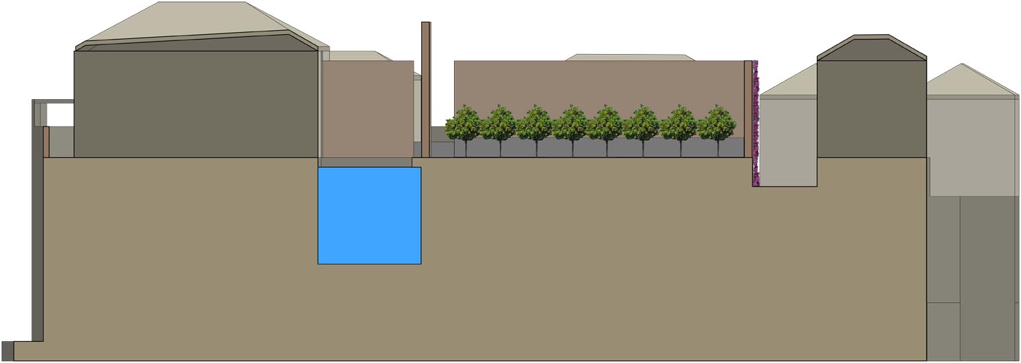
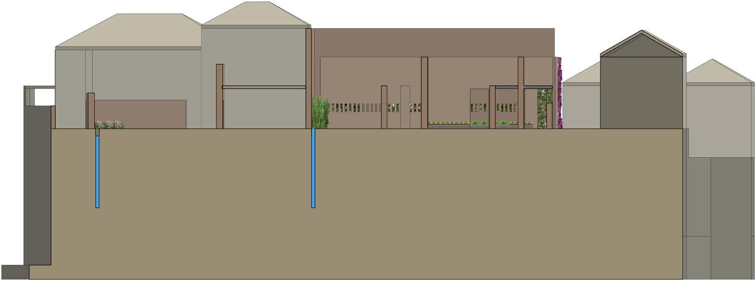
The study field in which I interfere and transform, is located in the Old Town at the rock of Monemvasia. The point of intervention is the southwestern edge of the castle which has access to the sea. This point was chosen because the settlement has a unique access from the west side of the rock and that unique element gave its name to Monemvasia. The port of Monemvasia was of strategic importance because of the direct communication with the city.
So to the existing grid of Monemvasia, we observe successive conversions of ruins to buildings, which were intended for touristical use. Although an attempt is made to maintain the typology and the architectural features in these conversions, I feel that congestion is created and leads to the transformation of Monemvasia in an unambiguous tourist destination.
In my attempt to suspend this tourist trend, I propose a different transformation of the remaining ruins of Monemvasia. I propose a reconstruction of these ruins, and instead of the prospect of a building, a creation of public spaces and clusters of semi-open or outdoor gardens. These gardens in total consist of many different plants (orange, sour orange, lemon, olive, bougainvillea, jasmine, prickly, reeds, basil, daisies, cyclamen), creating a potential grid, with direction to and from the sea, which aims to overturn the unambiguous touristic character of the town of Monemvasia and highlight its spatial densities in a different way.
Supervisors: Manolidis Kostas, Kouzoupi Aspassia
Reference Number: 333
Supervisor: Antonas Aristide
Reference Number: 319