Supervisors:
2010
«The metro is a place of reading, where the reader’s imagination can flutter», Marc Auge
The metro (subway) is a railway transit system of contemporary capital cities. The word comes from the Greek language (as a loan from the French word: métro < métropolitain < in Greek: metropolitan railway) and was used for the first time, in reference to the railway system, in 1900 in Paris (Μétro de Paris).
It concerns an underground transit network, which runs through the whole city and connects, in a direct way, places that could not until then be connected. However, the metro constitutes more than just a means of transport. The social, spatial, anthropological phenomena that take place in this underground network, the mobility and the immobility of the body inside the car, the time during the transition from the upper city to the underground or from one junction to another, the archaeological findings in cities like Athens, on the level the tunnels are being opened, transform the underground railway to a special form of transition.
The metro constitutes a spatial condition designed for a specific use from the city public, but open as to the way it is understood and defined. It could be characterized as an arcade, relatively to the structure and the function, a linear connection between areas of the city, as an urban threshold, an in-between place, which forms the passage from one place to another, from the surface of the city to the underground tunnels, as a place where movement of the city public is compressed and the corporeal feeling is intensified, while it has been used as inspiration to many artistic, literary, mythological and cinematographic works of art.
This research attempts to construct a multiple way of reading the “metro” phenomenon, using all the characteristics and the particularities of a personal, cognitive map. A cognitive map gives the possibility to the individual to reconstruct an articulated, memorable whole, that he/she can map over and over again, while drawing the several orbits of his/hers movements inside it. Cognitive mapping, in general, requires the inclusion of existential data (empirical position of the individual) and neuter, abstract notions of the geographic whole, as F. Jameson cites in his book “Postmodernism”.
Through the studying and analyzing multiple definitions and phenomena of the network, the term “underground railway system” and its relation to the upper city are being redefined. At the same time as analyzing the above notions, thoughts and personal experiences are being written down, during the “journey” inside the Athenian metro.
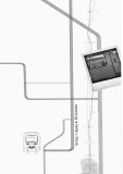
The material (subjects, photographs, diagrams) is organized on a double faced map. When the map is being read, its two sides converse to each other, in the exact same way the upper city converses to the subway network. One side represents a diagrammatic representation of the urban network of Athens and here are organized all the subjects that refer to the relationship between the metro and the upper city as well as the transition from the surface to the underground. The other side represents a diagrammatic map of the Athenian metro system and here are organized all the subjects that refer to the underground railway (platforms, trains, tunnels) and the phenomena that one can meet in these places. Every station of the railway network is imprinted with a round cut on surface of the map, representing the way the entrances of the metro perforate the city web. In this way, the two sides of the map connect to each other, literally as the texts of the two sides mix optically, as well as associatively, since the cuts of the stations leave their trace on the side of the city, infecting the way the map is read and interpreted.
The reading of the texts can be done in different ways, depending on the way the map is being folded: a) the linear way, where the reader follows the course of the texts as it appears in the digital record (cd), b) the suggested way, where the folding of the map creates four mini-books, c) the full-view reading of the two sides of the map when holding the map open, d) but also randomly chosen ways of reading that the readers create by folding the map the way they choose. In the suggested way of reading, every mini-book (four in the whole- two for every side of the map) can be read both ways. In general, the reading of the map can be done in all axes (x, y, z), following the way the human body navigates inside the areas of the network. Folding the map in several ways, one can meet upside down pictures, isolated parts of the overall routes, fragmentary information or combinations of their pieces, while not expected connections of pictures and texts can be created. Examples of the different ways of folding the map can be seen in the reading manual.
In all, the research is organized as a pocket map- instrument of navigation in the areas of the underground network, which is read and is constantly regenerated, including alternations of conclusion and interpretation, depending on the choices and the actions of the reader-“traveler”, during their personal navigation in the metro network.
This book is the evolution of the map, following the double pages that can be seen in the four mini-books (suggested way of reading). The book also follows the separate two sides of the map and therefore it can be read both from the beginning or the end. With this book comes a mockup of the original map which can be used as a guide to the reading of the book.
