'Phaleron' means white, pure, transparent, foamy. The ancient Phaleron in Archaic and Classical times was the most important port of the time, until Themistocles and later Pericles formed the port of Piraeus and Phaleron became the second port of Athens.
Falirikos Bay is the natural outlet of the basin of Athens to the Saronic Gulf, where a resident of densely populated Athens has the opportunity of contact with water. In the early 1970s the bay was destroyed in the name of tourism development with extensive embankment, construction of the Flisvos marina and elevated Possidonos Ave. The organization of the Olympic Games in 2004 was associated with the construction of several new projects. After the Olympic Games the projects were abandoned and the areas that once bustled with life are now desolated and so the problems of urban space have exacerbated.
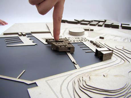
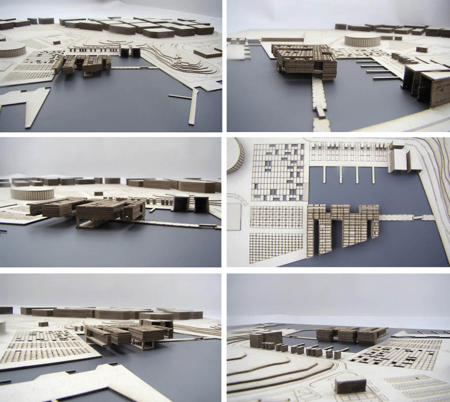
There was therefore a strong need to create an attraction pole, able to give life to this area and offer residents a place off and out of the urban web of the city. The first point was focused on the way the esplanade ends up in the water. We decided to keep the two hills intact since they formed a unique natural asset and were considered 'sacred' if we consider the existence of the ancient cemetery of Faliro.
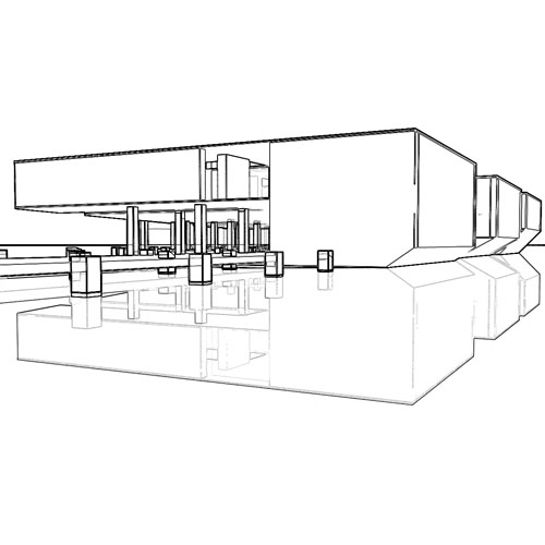
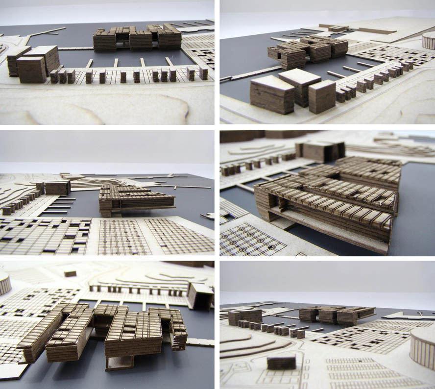
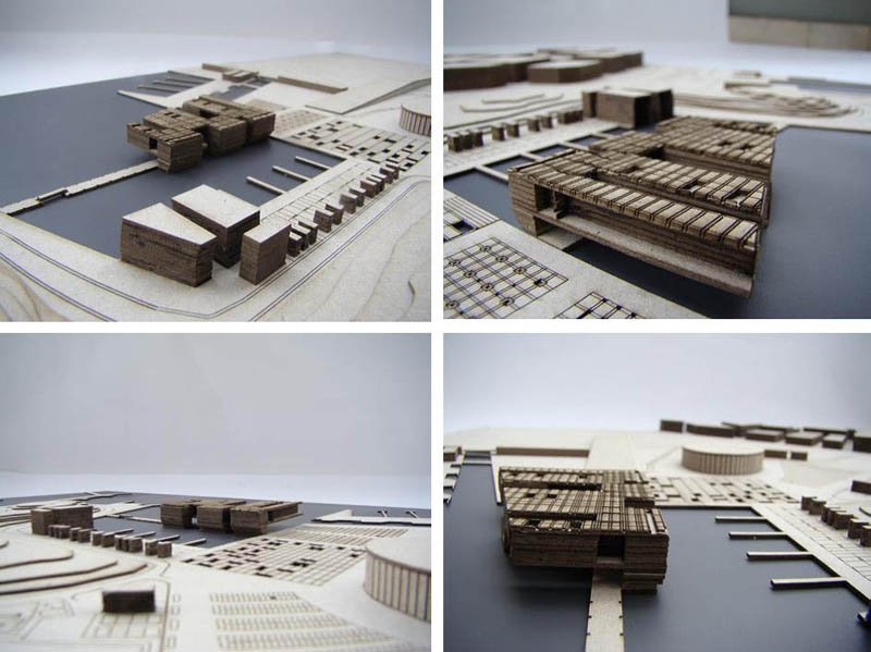
The imaginary line created by the esplanade and the cement port boundary were the main routes of the creation of our intervention. The pattern that emerged referred to a 'funnel' which was prepared to attract and absorb any visitor who commenced his drive from the esplanade to Faliro Bay. The existence of an artificial cluster of trees to the finish of the esplanade was the initial stimulus- in combination with the masts of the sailing vessels- which prompted us to design a grid 10X10 piles in the water which then became the foundation of the “airborne”, maritime museum. Our intention to place vessels as exhibits in the building led to the creation of notches which host and exhibit ships in their natural element.
The museum functions as a limit as well as an extension of the esplanade. Now the extension of the esplanade has a dual character. It functions as an association of two opposite banks joining the area of intervention with the galley and the Battleship Averof . It also constitutes the open grounds of the museum, an area of the museum where the public has the opportunity to observe on their right and left tied vessels - exhibits. On the corridor there is the entrance to the naval museum. The visitor to the museum is first forced to 'sink' in the lobby and then emerge at the center of the museum. By the same token, the sinking and the emergence, function the library and auditorium, parts of which are immersed in water . The program includes sites of periodic exhibition, a permanent exhibition, the administration of the museum, an area with an educational aspect and models, bookstore, cafe-restaurant, an area of virtual navigation and a maintenance area. A large corridor runs along the building and the above mentioned areas are on its right and left. The total area of the building is 7400 sq.m.
Before entering the museum we felt that it was necessary to create a relaxation site. Thus we designed three squares. Starting from the side of the sea we come across the 'square glass', the' water square 'and the' Square of the exhibition.
Apart from the redefinition of the esplanade we develop a plan for the regeneration of the coastal front of Marina Faliro. The new port is composed of levels of 25 cm, which range from sea level to street level across the region. In the most shaped beach front over the marina activities we placed cafes and restaurants wishing to achieve a line of relaxation . On the harbor we come across two museum –type arsenals where vessels that are part of the exhibition enter and there is a representation of a rudimentary way of maintenance. At the end of this zone and behind the arsenal we mounted a two-storey building with offices of general areas of supervision and administration of the harbor and the wider region.