The subject matter of the diplomatic study concerns the design and creation of the University structures and facilities in the department of the architects school in the city of Pafos. The necessity of restructuring and upgrading the sector of education in the specific area was the decisive factor in the choice of the subject matter, which will result to the strengthening and reformation of the education and culture of the local society in general.
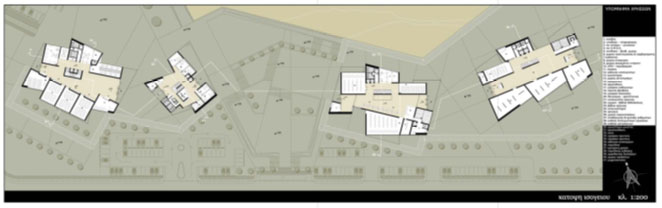
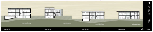
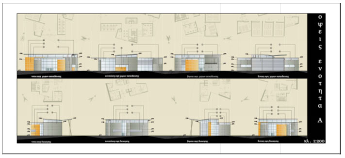
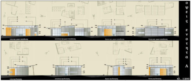
As a hint and starting point in the choice of the subject was the obvious lack of educational centers of the highest level due to the fact that the main activity of the people of Pafos is the agriculture and tourism. The aim of the study is to shape four territorial units which converse with the landscape and function simultaneously as autonomous and independent spaces (locations) separating and categorizing their functions and operations in two separate unities. The first unity refers to the administration and education and a second unity to the research and culture. In the first unity the functions and operations concerning the organization of the architectural department and carrying out of the schedule (program) of the students studies are incorporated. In the second unity the library building and the exhibition area are incorporated, aiming to encourage the research of the knowledge and the presentation of the actual results of the said knowledge.
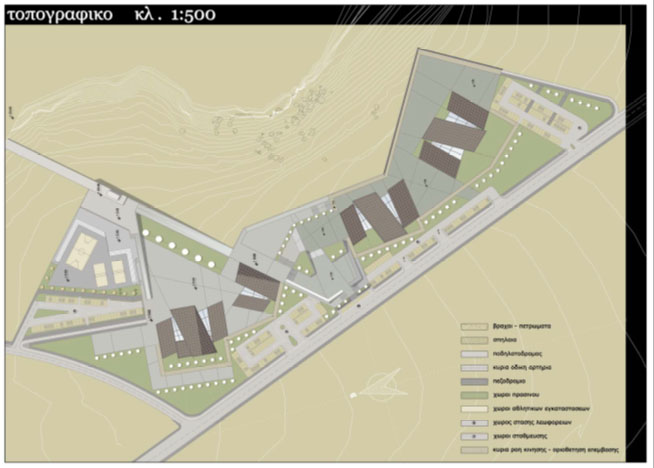
The plot on which the university buildings, installations and facilities will be built is within the region of the Yeroskipou municipality north-east of Pafos and consists the first part of the three elevations of the ground which was created during the geological years from the level of the sea, thus creating the existing topiography. Basic criterion in the choice of the location was the inclusion of the education buildings in the urban network of the city, having easy accessibility from any point of the area, and the gathering of symbolism and memories from the remains which witnesses the cultural and geological history of the area. The plot lies in the lower part of a sharp hypsometric (altitude) of about 23 meters, which practically disconnects the accessibility towards the built area of Yeroskipou and embraced by the city of Pafos in the north-west part creating a relativity between them. The extend of the plot is over 1000 donums. A special plan of development has already been designed for the said plot and combines projects such as hospital, medical centers, athletic installations, research centers, schools, residential and commercial units, shopping center and parks.
The linear continuation of the area between the two sectors (Yeroskipou-Plot) is interrupted by the steep hypsometric difference which becomes a natural boundary thus obstructing the direct access to the project, therefore the building of a pedestrian bridge which connects the project with the roads network leading to the points of reference within the city and in the proposed central square (piazza) which unifies the two functional and operational unities of the architectural school.
The natural division limit finally worked out in a different way in this case, since it placed at the same time the direction line in the continuous successive arrangement of the area units following the topiography of the area in a horizontal axis. The combination of the topiography by using a system of conceivable mappings that results out of the streets and which the limits the spaces and shapes of the rules and principles of designing. As a final result a shape and design of the buildings comes out through an analysis procedure by deeping into the elements and characteristics of the area and its history.