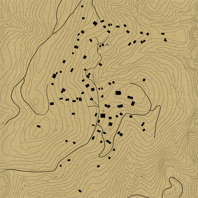
The settlement of Ano Kerasia is located on the western slopes of northern Pelion and was abandoned by its inhabitants when it was completely destroyed by German occupation forces in 1944. Apart from minimal interventions, most of the buildings of the settlement are kept in ruins. From 2015 the settlement of Ano Kerassia is characterized as a historical site and is protected by Ministerial Decree of the Ministry of Culture and Sports.Within the framework of the research it was attempted, through the tour to the settlement, to record the current situation and the location of all ruins. For this purpose, documentation such as maps, topographic diagrams, aerial photographs, satellite material and archival material was searched for and used. Since the main object of the project is not the historical analysis of the settlement but the recording of its ruins, there was no extensive search for bibliographic sources concerning the settlement, which are in any case limited. Further information was gained through discussions with old residents of Ano Kerasia.The logging method followed, based on the completion of tabs that were adapted to the conservation form of the settlement. From the processing and analysis of the contents of the tabs, there were thematic maps for the settlement focusing on the uses, the conservation status and the need for immediate protection. Particular emphasis was placed on landmarks of the settlement, which were of particular importance not only because of their architectural forms but also because of their place in the social life of the inhabitants.While most of the settlement is heading for extinction, recording its traces, even in 2017, helps to save the scant evidence found in its place. The mapping of the location of these examples of folk architecture can be of particular importance in the collective memory of the inhabitants.